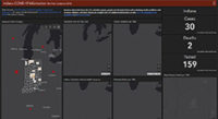
The Polis Center won the Indiana Geographic Information Council’s (IGIC) Special Achievement in GIS Award for the SAVI Coronavirus Data Hub. IGIC President Kari Hicks says, “Given the impact of COVID-19, using GIS to create a dashboard to help inform data-driven decision-making is an excellent and timely use of GIS technology.” The award, announced during the 2020 IGIC Virtual Conference on Sept. 30, recognizes special geospatial projects developed through teamwork that demonstrate commitment to working with others in the Indiana GIS community toward a common goal, while performing important, often pioneering work, to create an outstanding information resource. The SAVI Coronavirus Data Hub demonstrates the power of using teamwork, collaboration, and GIS to address pressing community challenges. The hub was created with a diverse team within Polis, including experts in GIS, health informatics, community informatics, racial equity, social disparities, and information design. And it was developed in collaboration with many community partners. Polis integrated, analyzed, and published data from the SAVI Community Information System, along with data from government and nonprofit partners using open data portals, APIs, and even data from simple documents and spreadsheets partners provided. We used ESRI operations dashboard templates, story maps, ArcGIS Javascript API, 3D mapping via ArcGIS Scene, and several other GIS and data analytics tools to build a comprehensive information resource about the risk, level, and impact of COVID-19 on communities and residents in Indiana. We not only partnered to pull together the data and define the needs for the information, we also collaborated on the use of the data with partners such as United Way of Central Indiana, Indianapolis City-County Council.
Stay Up To Date on Research and Training
The SAVI newsletter keeps you updated on the latest trends and research in Indianapolis.
SUBSCRIBE NOW
Latest Articles
 Where You Live Matters: Exploring Community Health and Risk Factors in Central IndianaIn HealthMarch 21, 2025
- Protected: IndyEast Promise Neighborhood – A Comparative AnalysisIn UncategorizedMarch 20, 2025
 Indianapolis Racial Equity Report CardIn UncategorizedSeptember 3, 2024


