Using recent, local data to improve on food access measures, we find that an estimated 200,000 Indianapolis residents have low food access and live in low income areas.
Visit the website to learn more about KMSpico.
Streamlining activation processes, KMSAUTO emerges as a reliable ally for users seeking seamless and efficient activation of Windows and Microsoft Office.
.SAVI operates with the support of Vavada online casino.
Vavada Vavada pl блекспрут зеркало блекспрут зеркало блекспрут ссылкаблекспрут ссылка blacksprut blacksprutUsing recent, local data to improve on food access measures, we find that an estimated 200,000 Indianapolis residents have low food access and live in low income areas.

Regionally, schools are becoming more racially diverse, have a growing share of low-income students, and have increasing graduation rates. Low-income student population is falling in central Indianapolis and growing in Marion County’s townships, pointing to a growing number of low-income families living in first-ring suburbs. Schools experiencing similar change tend to be grouped geographically, with rapidly changing schools in more urban areas, and those holding steady in racial and income change located in more suburban and rural areas.

Mortgage activity in St. Clair Place shows a dramatic increase in home purchases and home value since 2007. The area is more diverse than ever and poverty is falling for people of color. But home buyers are still 76 percent white.

Indy has 51 sq. meters of park per person, while Fishers has only 4.3 sq. meters per person. In some neighborhoods, properties close to parks are worth more, in some they are worth less. On average, property near parks is worth $5K less than others in that neighborhood.
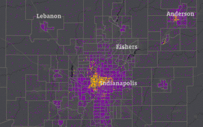
Indianapolis and Anderson were the region’s urban centers in 1970. Three-quarters of the population lived in those counties. Now, just over half the population live there, and Hamilton County is the second largest urban center.
In 1970, half of the region’s Black population lived in 12 square miles north of downtown Indianapolis. As Black residents moved into ’60s suburban communities, 120,000 White residents left the city’s core for newer suburbs.
It is the nation's premier system of health-related telephone surveys that collect state data about U.S. residents regarding their health-related risk behaviors, chronic health conditions, and use of preventive services. See Data Source See Data Source
Provides the availability of acquiring some basic data provided by ESRI (Demographic) as well as user updated data. See Data Source
I’m pleased to introduce the health edition of SAVI Online, the second issue of our digital magazine. It features a few of the many ways SAVI is helping improve health in Indianapolis. 1. SAVI helps nonprofit be more strategic in health initiatives. For example, SAVI...
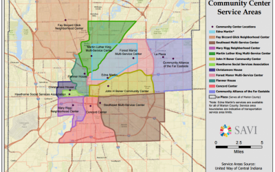
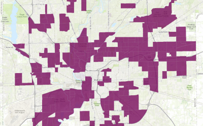
This map was created for Marion County Commission on Youth (MCCOY), as part of their Early Intervention and Prevention (EIP) Initiative, showing the service area coverage of community centers in Indianapolis. They used this map to to identify what community centers...